 vesseltracker.com
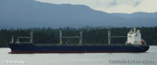
Vessel Star Lygra IMO: 9616838, MMSI: 538005562 Multi Purpose Carrier
UTC, -8.20959, -96.09924, course: 284, speed: 9.9
UTC, -8.17206, -96.32150, course: 280, speed: 10.2
2026-03-01 23:44:22 UTC, -8.11669, -96.63967, course: 281, speed: 9.9
Live AIS position:
UTC. Open sea (no nearby ports in database)),
updated 2026-03-01 23:44:22 UTC.
Find the position of the vessel Star Lygra on the map. The latter are known coordinates and path.
marine traffic ship tracker show on live map
The current position of vessel Star Lygra is -8.11669 lat / -96.63967 lng. Updated: 2026-03-01 23:44:22 UTCDetails:
Last coordinates of the vessel:
UTC, -8.31396, -95.66006, course: 286, speed: 10UTC, -8.20959, -96.09924, course: 284, speed: 9.9
UTC, -8.17206, -96.32150, course: 280, speed: 10.2
2026-03-01 23:44:22 UTC, -8.11669, -96.63967, course: 281, speed: 9.9