 vesseltracker.com
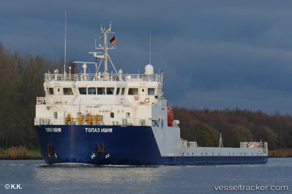
Vessel TOPAZ ISHIM IMO: 9812183, MMSI: 538007335 Heavy Load Carrier
UTC, 28.31082, 49.77468, course: -1, speed: 0.2
UTC, 28.31036, 49.77580, course: -1, speed: 0.1
2026-03-20 14:14:40 UTC, 28.31041, 49.77531, course: -1, speed: 0.1
Live Vessel TOPAZ ISHIM Analytics (details, animations, etc.)
Live AIS position: UTC. 46 nm S of Soroosh (Cyrus) Terminal), updated 2026-03-20 14:14:40 UTC.Find the position of the vessel TOPAZ ISHIM on the map. The latter are known coordinates and path.
marine traffic ship tracker show on live map
The current position of vessel TOPAZ ISHIM is 28.31041 lat / 49.77531 lng. Updated: 2026-03-20 14:14:40 UTCCurrently sailing under the flag of Marshall Islands
TOPAZ ISHIM built in 2017 year
Deadweight:
2946 tDetails:
Last coordinates of the vessel:
UTC, 28.31097, 49.77465, course: -1, speed: 0.6UTC, 28.31082, 49.77468, course: -1, speed: 0.2
UTC, 28.31036, 49.77580, course: -1, speed: 0.1
2026-03-20 14:14:40 UTC, 28.31041, 49.77531, course: -1, speed: 0.1