 vesseltracker.com
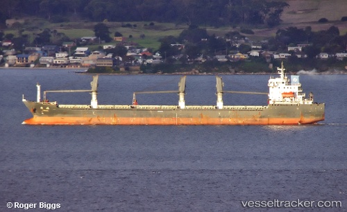
Vessel COPPER LADY IMO: 9481623, MMSI: 538008186 Bulk Carrier
UTC, 36.05300, 18.71705, course: 92, speed: 12.9
UTC, 36.05300, 18.71705, course: 92, speed: 12.9
2026-02-24 07:33:26 UTC, 36.05300, 18.71705, course: 92, speed: 12.9
Live AIS position:
UTC. 105 nm E of Ryuo),
updated 2026-02-24 07:33:26 UTC.
Find the position of the vessel COPPER LADY on the map. The latter are known coordinates and path.
marine traffic ship tracker show on live map
The current position of vessel COPPER LADY is 36.05300 lat / 18.71705 lng. Updated: 2026-02-24 07:33:26 UTCCurrently sailing under the flag of Marshall Islands
Details:
Last coordinates of the vessel:
UTC, 36.20997, 18.59602, course: 93, speed: 12.5UTC, 36.05300, 18.71705, course: 92, speed: 12.9
UTC, 36.05300, 18.71705, course: 92, speed: 12.9
2026-02-24 07:33:26 UTC, 36.05300, 18.71705, course: 92, speed: 12.9