.
vessel AGIA IRINI IMO: 9641821, Bulk Carrier vesseltracker.com
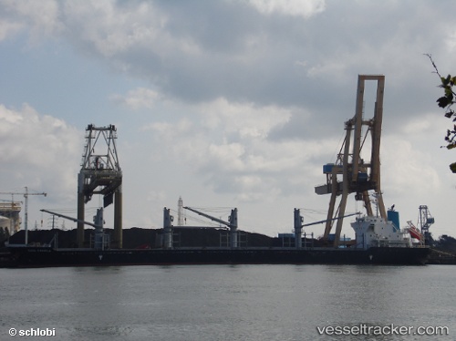
Vessel AGIA IRINI IMO: 9641821, MMSI: 538008636 Bulk Carrier

callsign: V7A2601
size: 170x27

Live AIS position: UTC. 186 nm NE of Abakaliki), updated 2026-02-19 10:35:20 UTC.

Find the position of the vessel AGIA IRINI on the map. The latter are known coordinates and path.

marine traffic ship tracker show on live map

The current position of vessel AGIA IRINI is 9.17504 lat / 87.24626 lng. Updated: 2026-02-19 10:35:20 UTC

Currently sailing under the flag of Marshall Islands

AGIA IRINI built in 2013 year

Deadweight:
28207 t

Details:


Last coordinates of the vessel:
2026-02-19 10:35:20 UTC, 9.17504, 87.24626, course: -1, speed: 57.1

Track of the vessel in the last 28 days


Most frequent ports a vessels calls at AGIA IRINI (538008636):

Sankt-Peterburg, traffic: 3
Le Harve, traffic: 2
Koper, traffic: 2
Le Havre, traffic: 2
Rouen, traffic: 2
Skagens Odde, traffic: 2
Helsingor, traffic: 1
Strait Of Gibraltar, traffic: 1
Honfleur, traffic: 1
Uskudar, traffic: 1
Istanbul, traffic: 1
Baltiysk, traffic: 1
Larnaca, traffic: 1
Ust-Luga, traffic: 1
Bassens, traffic: 1

Link to the map:


Find another ship

AGIA_IRINI (538008636) last ports (portcalls and passsages)

Uskudar | 2023-08-01 06:32:15
Larnaca | 2023-07-23 21:52:16
Koper | 2023-07-15 18:34:37
Koper | 2023-07-11 18:02:20
Strait Of Gibraltar | 2023-07-05 15:23:52
Skagens Odde | 2023-06-29 09:11:31
Sankt-Peterburg | 2023-06-24 04:05:24
Baltiysk | 2023-06-07 18:59:20
Skagens Odde | 2023-06-05 16:08:56
Santana | 2023-05-11 01:33:14
Ust-Luga | 2023-02-15 02:24:57
Helsingor | 2023-02-08 02:39:12
Bayonne | 2023-01-31 14:47:16
Bordeaux | 2023-01-30 05:39:26
Le Harve | 2023-01-24 23:23:09
Rouen | 2023-01-22 23:20:05
Rouen | 2023-01-18 23:19:09
Le Harve | 2023-01-18 15:13:49
Sankt-Peterburg | 2023-01-07 23:39:32
Sankt-Peterburg | 2023-01-03 09:12:35