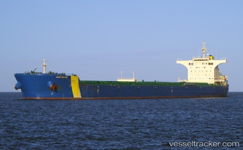
vessel '538009226' IMO: 9434448, vesseltracker.com
Vessel '538009226' IMO: 9434448,
MMSI: 538009226 callsign: size: x

Find the position of the vessel '538009226' on the map. The latter are known coordinates and path.

marine traffic ship tracker show on live map

The current position of vessel '538009226' is -63.04547 lat / -170.41603 lng. Updated: 2025-11-09 02:33:30 UTC
Details:


Last coordinates of the vessel:
UTC, -63.67491, -85.21764, course: 327, speed: 17.7
UTC, -63.04547, -170.41603, course: 72, speed: 17.7
2025-11-09 02:33:30 UTC, -63.04547, -170.41603, course: 72, speed: 17.7

Track of the vessel in the last 14 days


Most frequent ports a vessels calls at '538009226' (538009226):

Port Hedland, traffic: 4
Port Headland, traffic: 4
Makassar, traffic: 3
Samson Point, traffic: 2
Bur Ibrahim, traffic: 2
Wu-Sung, traffic: 2
Wusong, traffic: 2
Yosu, traffic: 2
Port Walcot, traffic: 2
Qingdao, traffic: 2
Ra’S Shukhayr, traffic: 1
Sambu, traffic: 1
Selat Lombok, traffic: 1
Singapore, traffic: 1
Lianyungang, traffic: 1

Link to the map:


Find another ship

'538009226' (538009226) last ports (portcalls and passsages)

Samson Point | 2024-01-10 21:21:48
Singapore | 2023-12-14 22:59:54
Lianyungang | 2022-12-24 11:34:59
Samson Point | 2022-12-02 12:01:40
Makassar | 2022-11-16 17:35:00
Makassar | 2022-11-12 17:03:58
Makassar | 2022-11-08 14:37:23
Wusong | 2022-10-20 13:14:25
Wusong | 2022-10-15 07:50:33
Selat Lombok | 2022-09-28 14:01:39
Port Headland | 2022-09-24 01:27:17
Ra’S Shukhayr | 2022-08-11 01:41:06
Bur Ibrahim | 2022-08-10 16:45:06
Bur Ibrahim | 2022-07-13 07:30:53
Newcastle | 2022-05-10 04:03:55
Port Headland | 2022-03-22 12:15:09
Qingdao | 2022-03-03 09:53:53
Port Headland | 2022-02-11 06:16:05
Yosu | 2021-12-20 05:31:57