 vesseltracker.com
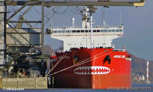
Vessel NORDIC ODIN IMO: 9687239, MMSI: 538009297 Bulk Carrier
UTC, 36.87957, -76.32642, course: 276, speed: 0
UTC, 36.87956, -76.32637, course: 276, speed: 0.1
2026-02-23 19:25:51 UTC, 36.87962, -76.32645, course: 276, speed: 0
Live AIS position:
UTC. Near Norfolk),
updated 2026-02-23 19:25:51 UTC.
Find the position of the vessel NORDIC ODIN on the map. The latter are known coordinates and path.
marine traffic ship tracker show on live map
The current position of vessel NORDIC ODIN is 36.87962 lat / -76.32645 lng. Updated: 2026-02-23 19:25:51 UTCCurrently sailing under the flag of Marshall Islands
NORDIC ODIN built in 2015 year
Deadweight:
76180 tDetails:
Last coordinates of the vessel:
UTC, 36.87957, -76.32644, course: 276, speed: 0UTC, 36.87957, -76.32642, course: 276, speed: 0
UTC, 36.87956, -76.32637, course: 276, speed: 0.1
2026-02-23 19:25:51 UTC, 36.87962, -76.32645, course: 276, speed: 0