 vesseltracker.com
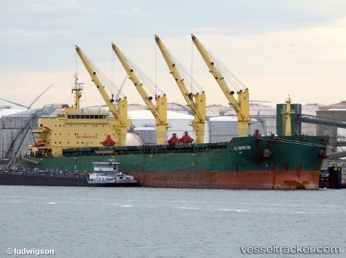
Vessel XIN HAI TONG 27 IMO: 9453262, MMSI: 538009401 Bulk Carrier
UTC, 3.04167, 101.35500, course: -1, speed: 0
UTC, 3.04268, 101.35644, course: -1, speed: 0
2026-02-26 21:25:46 UTC, 3.04271, 101.35643, course: -1, speed: 0
Live AIS position:
UTC. Near Port Klang (Ferry Port)),
updated 2026-02-26 21:25:46 UTC.
Find the position of the vessel XIN HAI TONG 27 on the map. The latter are known coordinates and path.
marine traffic ship tracker show on live map
The current position of vessel XIN HAI TONG 27 is 3.04271 lat / 101.35643 lng. Updated: 2026-02-26 21:25:46 UTCCurrently sailing under the flag of Marshall Islands
XIN HAI TONG 27 built in 2011 year
Deadweight:
56738 tDetails:
Last coordinates of the vessel:
UTC, 3.04167, 101.35500, course: -1, speed: 0UTC, 3.04167, 101.35500, course: -1, speed: 0
UTC, 3.04268, 101.35644, course: -1, speed: 0
2026-02-26 21:25:46 UTC, 3.04271, 101.35643, course: -1, speed: 0