 vesseltracker.com
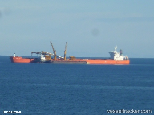
Vessel DUKESHIP IMO: 9402304, MMSI: 538009710 Bulk Carrier
UTC, -15.20670, -75.26063, course: 182, speed: 0
UTC, -15.20665, -75.26087, course: 174, speed: 0
2026-02-27 17:41:06 UTC, -15.20662, -75.26098, course: 171, speed: 0
Live AIS position:
UTC. Near San Nicolas),
updated 2026-02-27 17:41:06 UTC.
Find the position of the vessel DUKESHIP on the map. The latter are known coordinates and path.
marine traffic ship tracker show on live map
The current position of vessel DUKESHIP is -15.20662 lat / -75.26098 lng. Updated: 2026-02-27 17:41:06 UTCCurrently sailing under the flag of Marshall Islands
DUKESHIP built in 2010 year
Deadweight:
181453 tDetails:
Last coordinates of the vessel:
UTC, -15.20670, -75.26091, course: 177, speed: 0UTC, -15.20670, -75.26063, course: 182, speed: 0
UTC, -15.20665, -75.26087, course: 174, speed: 0
2026-02-27 17:41:06 UTC, -15.20662, -75.26098, course: 171, speed: 0