 vesseltracker.com
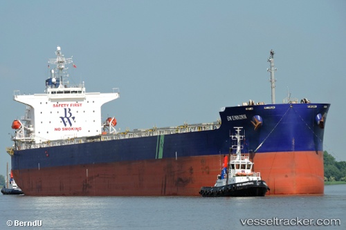
Vessel DUKE II IMO: 9399090, MMSI: 538010368 Bulk Carrier
UTC, 28.45212, -16.11221, course: 148, speed: 0.9
UTC, 28.42780, -16.10067, course: 247, speed: 0.9
2026-03-20 16:05:37 UTC, 28.46242, -16.10302, course: 173, speed: 1.5
Live Vessel DUKE II Analytics (details, animations, etc.)
Live AIS position: UTC. Near Cueva Bermeja), updated 2026-03-20 16:05:37 UTC.Find the position of the vessel DUKE II on the map. The latter are known coordinates and path.
marine traffic ship tracker show on live map
The current position of vessel DUKE II is 28.46242 lat / -16.10302 lng. Updated: 2026-03-20 16:05:37 UTCCurrently sailing under the flag of Marshall Islands
Details:
Last coordinates of the vessel:
UTC, 28.43009, -16.13749, course: 137, speed: 0.7UTC, 28.45212, -16.11221, course: 148, speed: 0.9
UTC, 28.42780, -16.10067, course: 247, speed: 0.9
2026-03-20 16:05:37 UTC, 28.46242, -16.10302, course: 173, speed: 1.5