 vesseltracker.com
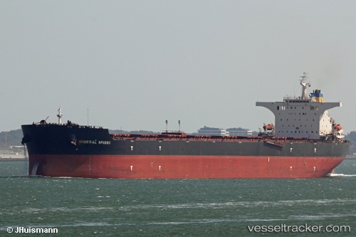
 ASL POLARIS
Current Status
Where is the vessel?
ASL POLARIS is currently in Near ITAGUAI, based on AIS data received about 1h ago.
Latest AIS update:
Current position: 22.93500° S, 43.82833° W (Near ITAGUAI)
Average speed (last 7 days): Loading…
Average speed (last 30 days): Loading…
Vessel profile: ASL POLARIS is a Cargo with dimensions m x m.
This page combines live AIS, route history, probable destination signals, nearby traffic, and port activity for practical vessel monitoring.
The current position of vessel ASL POLARIS is -22.93500 lat / -43.82833 lng. Updated: 2026-03-25 20:12:55 UTCNearest reference points:
- Near ILHA GUAIBA
- Near SANTA RITA
- Near CUNHAMBEBE
Currently sailing under the flag of Marshall Islands ![]()
Details:
Live Vessel ASL POLARIS Analytics (details, animations, etc.)
Recent AIS points (UTC):
2026-03-25 14:02:38 UTC · -22.97359, -43.96267 · SOG 0.1 kn · COG 161°2026-03-25 15:23:44 UTC · -22.95588, -43.85625 · SOG 8.5 kn · COG 55°
2026-03-25 17:25:48 UTC · -22.93651, -43.82842 · SOG 0 kn · COG 265°
2026-03-25 20:12:55 UTC · -22.93500, -43.82833 · SOG 0 kn · COG -1°