 vesseltracker.com
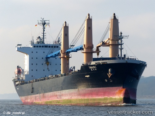
Vessel IMARI IMO: 9567776, MMSI: 538011521 General Cargo
UTC, 22.92017, 70.37221, course: 258, speed: 0.4
UTC, 22.92009, 70.37237, course: 257, speed: 0.1
2026-03-25 02:00:58 UTC, 22.91770, 70.36838, course: 87, speed: 0.6
Live Vessel IMARI Analytics (details, animations, etc.)
Live AIS position: UTC. Near Navlakhi), updated 2026-03-25 02:00:58 UTC.Find the position of the vessel IMARI on the map. The latter are known coordinates and path.
marine traffic ship tracker show on live map
The current position of vessel IMARI is 22.91770 lat / 70.36838 lng. Updated: 2026-03-25 02:00:58 UTCCurrently sailing under the flag of Marshall Islands
Details:
Last coordinates of the vessel:
UTC, 22.91965, 70.37167, course: 258, speed: 0.1UTC, 22.92017, 70.37221, course: 258, speed: 0.4
UTC, 22.92009, 70.37237, course: 257, speed: 0.1
2026-03-25 02:00:58 UTC, 22.91770, 70.36838, course: 87, speed: 0.6