 vesseltracker.com
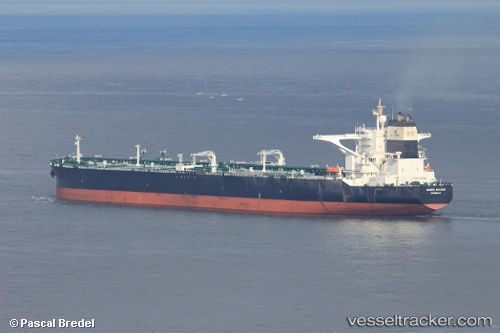
Vessel DHT AMAZON IMO: 9528794, MMSI: 538011754 Crude Oil Tanker
UTC, 21.05426, -82.95404, course: 109, speed: 12.1
UTC, 20.90056, -82.33460, course: 103, speed: 11.7
2026-03-19 07:54:48 UTC, 20.81022, -81.96220, course: 103, speed: 11.9
Live Vessel DHT AMAZON Analytics (details, animations, etc.)
Live AIS position: UTC. 54 nm SW of Cayo Largo del Sur), updated 2026-03-19 07:54:48 UTC.Find the position of the vessel DHT AMAZON on the map. The latter are known coordinates and path.
marine traffic ship tracker show on live map
The current position of vessel DHT AMAZON is 20.81022 lat / -81.96220 lng. Updated: 2026-03-19 07:54:48 UTCCurrently sailing under the flag of Marshall Islands
Details:
Last coordinates of the vessel:
UTC, 21.17353, -83.41208, course: 111, speed: 11.6UTC, 21.05426, -82.95404, course: 109, speed: 12.1
UTC, 20.90056, -82.33460, course: 103, speed: 11.7
2026-03-19 07:54:48 UTC, 20.81022, -81.96220, course: 103, speed: 11.9