 vesseltracker.com
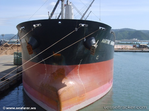
Vessel MARITIME HARMONY IMO: 9442990, MMSI: 538012119 Bulk Carrier
UTC, 36.83847, 122.26662, course: 269, speed: 0
UTC, 36.83847, 122.26665, course: 269, speed: 0
2026-03-24 17:30:02 UTC, 36.83860, 122.26667, course: 270, speed: 0
Live Vessel MARITIME HARMONY Analytics (details, animations, etc.)
Live AIS position: UTC. Near Shidao Pt), updated 2026-03-24 17:30:02 UTC.Find the position of the vessel MARITIME HARMONY on the map. The latter are known coordinates and path.
marine traffic ship tracker show on live map
The current position of vessel MARITIME HARMONY is 36.83860 lat / 122.26667 lng. Updated: 2026-03-24 17:30:02 UTCCurrently sailing under the flag of Marshall Islands
Details:
Last coordinates of the vessel:
UTC, 36.83858, 122.26667, course: 270, speed: 0UTC, 36.83847, 122.26662, course: 269, speed: 0
UTC, 36.83847, 122.26665, course: 269, speed: 0
2026-03-24 17:30:02 UTC, 36.83860, 122.26667, course: 270, speed: 0