 vesseltracker.com
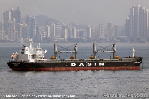
Vessel PEACE BAND IMO: 9569956, MMSI: 538012178 Bulk Carrier
UTC, -3.30333, -6.71667, course: -1, speed: 11
UTC, -3.03618, -6.91552, course: 326, speed: 11.4
2026-02-25 12:10:21 UTC, -2.61040, -7.22482, course: 325, speed: 11.4
Live AIS position:
UTC. Open sea, approx. 415 nm off the nearest listed port),
updated 2026-02-25 12:10:21 UTC.
Find the position of the vessel PEACE BAND on the map. The latter are known coordinates and path.
marine traffic ship tracker show on live map
The current position of vessel PEACE BAND is -2.61040 lat / -7.22482 lng. Updated: 2026-02-25 12:10:21 UTCCurrently sailing under the flag of Marshall Islands
Details:
Last coordinates of the vessel:
UTC, -3.51023, -6.56427, course: 324, speed: 11.7UTC, -3.30333, -6.71667, course: -1, speed: 11
UTC, -3.03618, -6.91552, course: 326, speed: 11.4
2026-02-25 12:10:21 UTC, -2.61040, -7.22482, course: 325, speed: 11.4