 vesseltracker.com
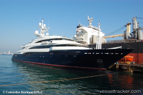
Vessel Amevi IMO: 1009118, MMSI: 538070869 Service Ship
UTC, 26.68700, -77.16772, course: 312, speed: 0
UTC, 26.68703, -77.16772, course: 90, speed: 0
2026-02-25 19:37:29 UTC, 26.68676, -77.16779, course: 273, speed: 0.5
Live AIS position:
UTC. Near Green Turtle Cay),
updated 2026-02-25 19:37:29 UTC.
Find the position of the vessel Amevi on the map. The latter are known coordinates and path.
marine traffic ship tracker show on live map
The current position of vessel Amevi is 26.68676 lat / -77.16779 lng. Updated: 2026-02-25 19:37:29 UTCDetails:
Last coordinates of the vessel:
UTC, 26.68702, -77.16777, course: 267, speed: 0UTC, 26.68700, -77.16772, course: 312, speed: 0
UTC, 26.68703, -77.16772, course: 90, speed: 0
2026-02-25 19:37:29 UTC, 26.68676, -77.16779, course: 273, speed: 0.5