 vesseltracker.com
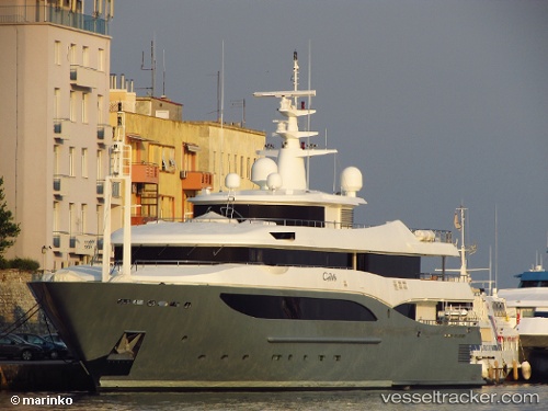
Vessel Constance IMO: 1008619, MMSI: 538071166 Service Ship
UTC, 18.01570, -63.05031, course: 60, speed: 0.2
UTC, 18.01587, -63.05027, course: 96, speed: 0.6
2026-02-28 00:29:27 UTC, 18.01561, -63.05008, course: 80, speed: 0.3
Live AIS position:
UTC. Near PHILIPSBURG),
updated 2026-02-28 00:29:27 UTC.
Find the position of the vessel Constance on the map. The latter are known coordinates and path.
marine traffic ship tracker show on live map
The current position of vessel Constance is 18.01561 lat / -63.05008 lng. Updated: 2026-02-28 00:29:27 UTCCurrently sailing under the flag of Marshall Is
Constance built in 2006 year
Deadweight:
200 tDetails:
Last coordinates of the vessel:
UTC, 18.01580, -63.05033, course: -1, speed: 0.2UTC, 18.01570, -63.05031, course: 60, speed: 0.2
UTC, 18.01587, -63.05027, course: 96, speed: 0.6
2026-02-28 00:29:27 UTC, 18.01561, -63.05008, course: 80, speed: 0.3