 vesseltracker.com
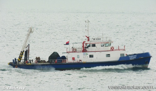
Vessel Panduan IMO: 9714549, MMSI: 563026590 Buoy Lighthouse Vessel
UTC, 1.25460, 103.83364, course: 286, speed: 6.2
UTC, 1.25460, 103.83364, course: 286, speed: 6.2
2026-03-13 04:19:28 UTC, 1.25460, 103.83364, course: 286, speed: 6.2
Live Vessel Panduan Analytics (details, animations, etc.)
Live AIS position: UTC. Near Singapore), updated 2026-03-13 04:19:28 UTC.Find the position of the vessel Panduan on the map. The latter are known coordinates and path.
marine traffic ship tracker show on live map
The current position of vessel Panduan is 1.25460 lat / 103.83364 lng. Updated: 2026-03-13 04:19:28 UTCDetails:
Last coordinates of the vessel:
UTC, 1.25460, 103.83364, course: 286, speed: 6.2UTC, 1.25460, 103.83364, course: 286, speed: 6.2
UTC, 1.25460, 103.83364, course: 286, speed: 6.2
2026-03-13 04:19:28 UTC, 1.25460, 103.83364, course: 286, speed: 6.2