 vesseltracker.com
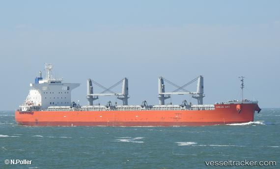
Vessel Sirius Sky IMO: 9817559, MMSI: 563033500 Bulk Carrier
UTC, -0.77097, 83.23772, course: 323, speed: 10.6
UTC, -0.35840, 82.90769, course: 321, speed: 11
2026-02-17 06:41:35 UTC, -0.24682, 82.81844, course: 323, speed: 11.2
Live AIS position:
UTC. 394 nm S of Mawella),
updated 2026-02-17 06:41:35 UTC.
Find the position of the vessel Sirius Sky on the map. The latter are known coordinates and path.
marine traffic ship tracker show on live map
The current position of vessel Sirius Sky is -0.24682 lat / 82.81844 lng. Updated: 2026-02-17 06:41:35 UTCDetails:
Last coordinates of the vessel:
UTC, -1.06916, 83.46914, course: 319, speed: 11.4UTC, -0.77097, 83.23772, course: 323, speed: 10.6
UTC, -0.35840, 82.90769, course: 321, speed: 11
2026-02-17 06:41:35 UTC, -0.24682, 82.81844, course: 323, speed: 11.2