 vesseltracker.com
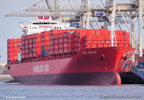
Vessel Cap Jervis IMO: 9484572, MMSI: 563052700 Container Ship
UTC, 15.02449, 112.63835, course: 29, speed: 14
UTC, 15.22332, 112.75858, course: 30, speed: 14
2026-01-17 04:20:03 UTC, 15.48971, 112.89757, course: 27, speed: 13.7
Live AIS position:
UTC. 206 nm NE of Tan Cang Qui Nhon),
updated 2026-01-17 04:20:03 UTC.
Find the position of the vessel Cap Jervis on the map. The latter are known coordinates and path.
marine traffic ship tracker show on live map
The current position of vessel Cap Jervis is 15.48971 lat / 112.89757 lng. Updated: 2026-01-17 04:20:03 UTCCurrently sailing under the flag of Singapore
Cap Jervis built in 2010 year
Deadweight:
59266 tDetails:
Last coordinates of the vessel:
UTC, 14.52333, 112.32667, course: -1, speed: 14UTC, 15.02449, 112.63835, course: 29, speed: 14
UTC, 15.22332, 112.75858, course: 30, speed: 14
2026-01-17 04:20:03 UTC, 15.48971, 112.89757, course: 27, speed: 13.7