 vesseltracker.com
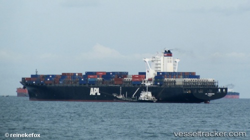
Vessel WAN HAI 721 IMO: 9398242, MMSI: 563130400 Container Ship
UTC, 28.72803, 32.98760, course: 337, speed: 13
UTC, 29.29428, 32.74135, course: 341, speed: 11.9
2026-03-02 12:23:20 UTC, 29.53765, 32.60157, course: 340, speed: 7.5
Live AIS position:
UTC. Near Ras Sudr),
updated 2026-03-02 12:23:20 UTC.
Find the position of the vessel WAN HAI 721 on the map. The latter are known coordinates and path.
marine traffic ship tracker show on live map
The current position of vessel WAN HAI 721 is 29.53765 lat / 32.60157 lng. Updated: 2026-03-02 12:23:20 UTCCurrently sailing under the flag of Singapore
WAN HAI 721 built in 2009 year
Deadweight:
90443 tDetails:
Last coordinates of the vessel:
UTC, 28.43846, 33.17225, course: -1, speed: 13.1UTC, 28.72803, 32.98760, course: 337, speed: 13
UTC, 29.29428, 32.74135, course: 341, speed: 11.9
2026-03-02 12:23:20 UTC, 29.53765, 32.60157, course: 340, speed: 7.5