 vesseltracker.com
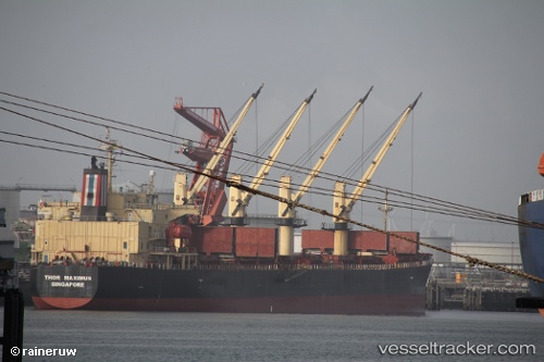
Vessel Thor Maximus IMO: 9291391, MMSI: 564756000 Bulk Carrier
UTC, 11.02833, 67.36167, course: -1, speed: 12
UTC, 11.19167, 66.89667, course: -1, speed: 11
2026-02-27 07:46:41 UTC, 11.28833, 66.59833, course: -1, speed: 11
Live AIS position:
UTC. 130 nm NW of Tinaquillo),
updated 2026-02-27 07:46:41 UTC.
Find the position of the vessel Thor Maximus on the map. The latter are known coordinates and path.
marine traffic ship tracker show on live map
The current position of vessel Thor Maximus is 11.28833 lat / 66.59833 lng. Updated: 2026-02-27 07:46:41 UTCCurrently sailing under the flag of Singapore
Thor Maximus built in 2005 year
Deadweight:
55695 tDetails:
Last coordinates of the vessel:
UTC, 10.91500, 67.75167, course: -1, speed: 12UTC, 11.02833, 67.36167, course: -1, speed: 12
UTC, 11.19167, 66.89667, course: -1, speed: 11
2026-02-27 07:46:41 UTC, 11.28833, 66.59833, course: -1, speed: 11