 vesseltracker.com
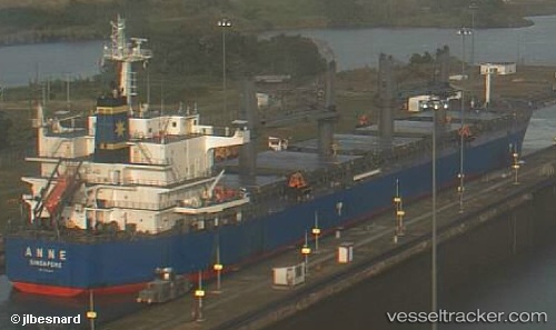
Vessel Anne IMO: 9593294, MMSI: 566262000 Bulk Carrier
UTC, 52.57608, -144.02100, course: 270, speed: 11.4
UTC, 52.65933, -144.20518, course: 296, speed: 11.4
2026-03-25 02:20:45 UTC, 52.90531, -144.95000, course: 297, speed: 11.1
Live Vessel Anne Analytics (details, animations, etc.)
Live AIS position: UTC. 147 nm E of Kings Bromley), updated 2026-03-25 02:20:45 UTC.Find the position of the vessel Anne on the map. The latter are known coordinates and path.
marine traffic ship tracker show on live map
The current position of vessel Anne is 52.90531 lat / -144.95000 lng. Updated: 2026-03-25 02:20:45 UTCDetails:
Last coordinates of the vessel:
UTC, 52.35006, -143.36240, course: 300, speed: 12.2UTC, 52.57608, -144.02100, course: 270, speed: 11.4
UTC, 52.65933, -144.20518, course: 296, speed: 11.4
2026-03-25 02:20:45 UTC, 52.90531, -144.95000, course: 297, speed: 11.1