 vesseltracker.com
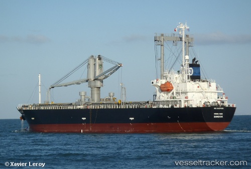
Nordana Malee
Current StatusWhere is the vessel?
Nordana Malee is currently in 13 nm NW of Hatoma, based on AIS data received about 2h ago.
Latest AIS update:
Current position: 24.65813° N, 123.64357° E (13 nm NW of Hatoma)
Average speed (last 7 days): Loading…
Average speed (last 30 days): Loading…
Vessel profile: Nordana Malee is a General Cargo Ship with dimensions 20m x 116m.
This page combines live AIS, route history, probable destination signals, nearby traffic, and port activity for practical vessel monitoring.
The current position of vessel Nordana Malee is 24.65813 lat / 123.64357 lng. Updated: 2026-03-25 17:04:15 UTCNearest reference points:
- 55 nm E of Nangang
- 13 nm NE of Nangang
- 14 nm NE of Nangang
Details:
Live Vessel Nordana Malee Analytics (details, animations, etc.)
Recent AIS points (UTC):
2026-03-25 06:13:36 UTC · 22.85190, 122.63453 · SOG 12.5 kn · COG 25°2026-03-25 06:13:36 UTC · 22.85190, 122.63453 · SOG 12.5 kn · COG 25°
2026-03-25 06:13:36 UTC · 22.85190, 122.63453 · SOG 12.5 kn · COG 25°
2026-03-25 17:04:15 UTC · 24.65813, 123.64357 · SOG 11.8 kn · COG 49°