 vesseltracker.com
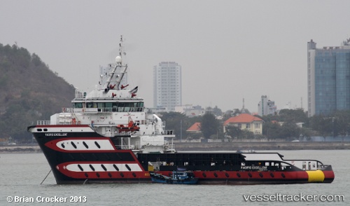
 BRITOIL DEFENDER
Current Status
Where is the vessel?
BRITOIL DEFENDER is currently in Near Pasir Panjang Wharves, based on AIS data received about 3h ago.
Latest AIS update:
Current position: 1.24865° N, 103.80417° E (Near Pasir Panjang Wharves)
Average speed (last 7 days): Loading…
Average speed (last 30 days): Loading…
Vessel profile: BRITOIL DEFENDER is a Anchor Handling Vessel with dimensions m x m.
This page combines live AIS, route history, probable destination signals, nearby traffic, and port activity for practical vessel monitoring.
The current position of vessel BRITOIL DEFENDER is 1.24865 lat / 103.80417 lng. Updated: 2026-03-25 07:40:45 UTCNearest reference points:
- Near Singapore
- Near Bukit Merah Estate
- Near Pasir Panjang Wharves
Currently sailing under the flag of Tuvalu ![]()
Details:
Live Vessel BRITOIL DEFENDER Analytics (details, animations, etc.)
Recent AIS points (UTC):
2026-03-25 02:07:56 UTC · 1.29624, 103.75427 · SOG 0 kn · COG 339°2026-03-25 04:02:34 UTC · 1.29500, 103.75333 · SOG 0 kn · COG -1°
2026-03-25 05:25:06 UTC · 1.29581, 103.75490 · SOG 1.4 kn · COG 298°
2026-03-25 07:40:45 UTC · 1.24865, 103.80417 · SOG 0.1 kn · COG -1°