 vesseltracker.com
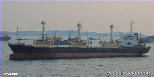
Vessel New Energy IMO: 9306524, MMSI: 574310000 Multi Purpose Carrier
Live Vessel New Energy Analytics (details, animations, etc.)
Live AIS position: UTC. 326 nm W of Nikumaroro), updated 2025-08-12 04:04:33 UTC.Find the position of the vessel New Energy on the map. The latter are known coordinates and path.
marine traffic ship tracker show on live map
The current position of vessel New Energy is -4.91817 lat / -179.95680 lng. Updated: 2025-08-12 04:04:33 UTCDetails:
Last coordinates of the vessel:
2025-08-12 04:04:33 UTC, -4.91817, -179.95680, course: -1, speed: 48.7