 vesseltracker.com
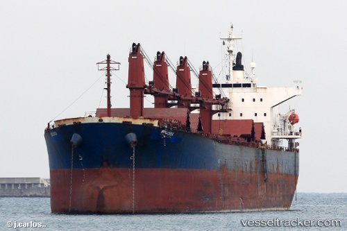
Vessel EAST HELIOS IMO: 9233387, MMSI: 577693000 Bulk Carrier
UTC, 19.96666, 116.91500, course: -1, speed: 10
UTC, 20.20167, 117.12167, course: -1, speed: 10
2026-03-21 19:52:54 UTC, 20.44833, 117.33500, course: -1, speed: 9
Live Vessel EAST HELIOS Analytics (details, animations, etc.)
Live AIS position: UTC. 147 nm E of Xijiang), updated 2026-03-21 19:52:54 UTC.Find the position of the vessel EAST HELIOS on the map. The latter are known coordinates and path.
marine traffic ship tracker show on live map
The current position of vessel EAST HELIOS is 20.44833 lat / 117.33500 lng. Updated: 2026-03-21 19:52:54 UTCCurrently sailing under the flag of Vanuatu
Details:
Last coordinates of the vessel:
UTC, 19.69833, 116.67167, course: -1, speed: 10UTC, 19.96666, 116.91500, course: -1, speed: 10
UTC, 20.20167, 117.12167, course: -1, speed: 10
2026-03-21 19:52:54 UTC, 20.44833, 117.33500, course: -1, speed: 9