 vesseltracker.com
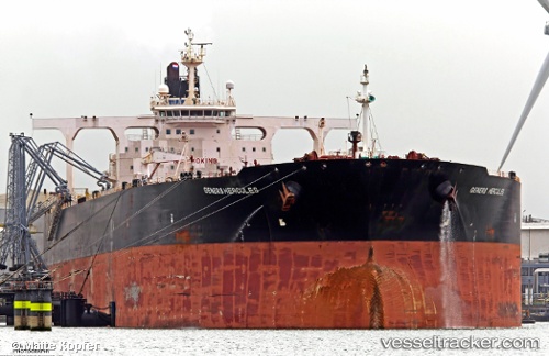
Vessel FEADSHIP IMO: 9322279, MMSI: 577697000 Crude Oil Tanker
UTC, 35.54342, 119.78435, course: 0, speed: 4.2
UTC, 35.57065, 119.77992, course: 55, speed: 0
2026-03-24 12:13:36 UTC, 35.57063, 119.77997, course: 55, speed: 0
Live Vessel FEADSHIP Analytics (details, animations, etc.)
Live AIS position: UTC. Near DONGJIAKOU), updated 2026-03-24 12:13:36 UTC.Find the position of the vessel FEADSHIP on the map. The latter are known coordinates and path.
marine traffic ship tracker show on live map
The current position of vessel FEADSHIP is 35.57063 lat / 119.77997 lng. Updated: 2026-03-24 12:13:36 UTCCurrently sailing under the flag of Vanuatu
Details:
Last coordinates of the vessel:
UTC, 35.32968, 119.98582, course: 289, speed: 8.1UTC, 35.54342, 119.78435, course: 0, speed: 4.2
UTC, 35.57065, 119.77992, course: 55, speed: 0
2026-03-24 12:13:36 UTC, 35.57063, 119.77997, course: 55, speed: 0