 vesseltracker.com
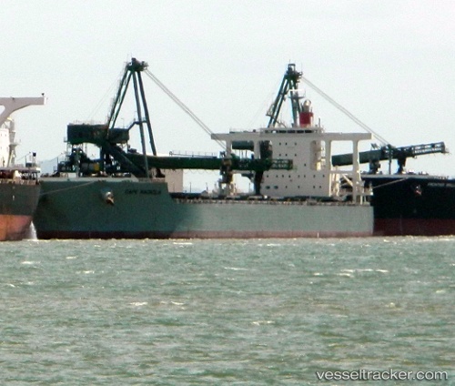
Vessel CAPE MAGNOLIA IMO: 9573787, MMSI: 601027720 Bulk Carrier
UTC, -28.50528, -9.92210, course: 283, speed: 13.4
UTC, -28.43580, -10.23940, course: 286, speed: 13.2
2026-03-24 13:55:35 UTC, -28.30164, -10.81406, course: 284, speed: 13.4
Live Vessel CAPE MAGNOLIA Analytics (details, animations, etc.)
Live AIS position: UTC. Open sea (no nearby ports in database)), updated 2026-03-24 13:55:35 UTC.Find the position of the vessel CAPE MAGNOLIA on the map. The latter are known coordinates and path.
marine traffic ship tracker show on live map
The current position of vessel CAPE MAGNOLIA is -28.30164 lat / -10.81406 lng. Updated: 2026-03-24 13:55:35 UTCCurrently sailing under the flag of South Africa
Details:
Last coordinates of the vessel:
UTC, -28.64664, -9.30913, course: 285, speed: 13.3UTC, -28.50528, -9.92210, course: 283, speed: 13.4
UTC, -28.43580, -10.23940, course: 286, speed: 13.2
2026-03-24 13:55:35 UTC, -28.30164, -10.81406, course: 284, speed: 13.4