 vesseltracker.com
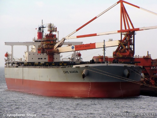
Vessel CAPE ACACIA IMO: 9281906, MMSI: 601919900 Bulk Carrier
Live AIS position:
UTC. 371 nm SW of Baía dos Tigres),
updated 2023-01-10 17:57:06 UTC.
Find the position of the vessel CAPE ACACIA on the map. The latter are known coordinates and path.
marine traffic ship tracker show on live map
The current position of vessel CAPE ACACIA is -20.40227 lat / 6.58845 lng. Updated: 2023-01-10 17:57:06 UTCCurrently sailing under the flag of South Africa
CAPE ACACIA built in 2005 year
Deadweight:
206237 tDetails:
Last coordinates of the vessel:
2023-01-10 17:57:06 UTC, -20.40227, 6.58845, course: 322, speed: 12.2