.
vessel Boracay IMO: 9332810, Crude Oil Tanker vesseltracker.com
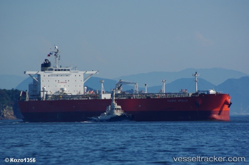
Vessel Boracay IMO: 9332810, MMSI: 610107116 Crude Oil Tanker

callsign: TYD16
size: 42x244

Live AIS position: UTC. 41 nm NE of PENGERANG), updated 2026-01-15 17:55:15 UTC.

Find the position of the vessel Boracay on the map. The latter are known coordinates and path.

marine traffic ship tracker show on live map

The current position of vessel Boracay is 1.77293 lat / 104.67853 lng. Updated: 2026-01-15 17:55:15 UTC

Currently sailing under the flag of Benin

Boracay built in 2007 year

Deadweight:
115577 t

Details:


Last coordinates of the vessel:
UTC, 1.77295, 104.67863, course: -1, speed: 0.1
UTC, 1.77293, 104.67853, course: -1, speed: 0.1
2026-01-15 17:55:15 UTC, 1.77293, 104.67853, course: -1, speed: 0.1

Track of the vessel in the last 28 days


Most frequent ports a vessels calls at Boracay (610107116):

VISTINO, traffic: 8
Ruch’I, traffic: 7
Primorsk, traffic: 2
Vlissingen, traffic: 1
Xiamen, traffic: 1
Cobn, traffic: 1
Cobh, traffic: 1
Flushing, traffic: 1
Hsia-Men, traffic: 1
Rotterdam, traffic: 1
Vlaardingen, traffic: 1

Link to the map:


Find another ship

Boracay (610107116) last ports (portcalls and passsages)

VISTINO | 2025-05-28 16:06:54
VISTINO | 2025-05-24 16:05:41
VISTINO | 2025-05-20 16:01:00
Primorsk | 2025-05-17 17:37:46
VISTINO | 2025-05-16 15:25:30
Ruch’I | 2025-05-16 14:10:40
VISTINO | 2025-05-12 14:22:08
Ruch’I | 2025-05-12 09:32:47
Primorsk | 2025-05-08 18:24:24
VISTINO | 2025-05-08 14:15:23
Ruch’I | 2025-05-06 13:45:22
VISTINO | 2025-05-04 13:37:39
Ruch’I | 2025-05-02 12:24:26
VISTINO | 2025-04-29 14:10:21
Xiamen | 2023-03-20 00:03:27
Vlissingen | 2023-01-27 20:02:54
Vlaardingen | 2023-01-15 05:20:41
Cobn | 2022-08-16 10:52:19