 vesseltracker.com
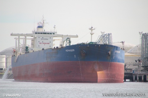
Vessel DESTAMAR IMO: 9253894, MMSI: 613271813 Crude Oil Tanker
UTC, 34.60598, 28.83776, course: 134, speed: 11.7
UTC, 34.60598, 28.83776, course: 134, speed: 11.7
2026-03-24 03:44:17 UTC, 34.60598, 28.83776, course: 134, speed: 11.7
Live Vessel DESTAMAR Analytics (details, animations, etc.)
Live AIS position: UTC. 95 nm SE of Kárpathos), updated 2026-03-24 03:44:17 UTC.Find the position of the vessel DESTAMAR on the map. The latter are known coordinates and path.
marine traffic ship tracker show on live map
The current position of vessel DESTAMAR is 34.60598 lat / 28.83776 lng. Updated: 2026-03-24 03:44:17 UTCCurrently sailing under the flag of Cameroon
Details:
Last coordinates of the vessel:
UTC, 34.60598, 28.83776, course: 134, speed: 11.7UTC, 34.60598, 28.83776, course: 134, speed: 11.7
UTC, 34.60598, 28.83776, course: 134, speed: 11.7
2026-03-24 03:44:17 UTC, 34.60598, 28.83776, course: 134, speed: 11.7