 vesseltracker.com
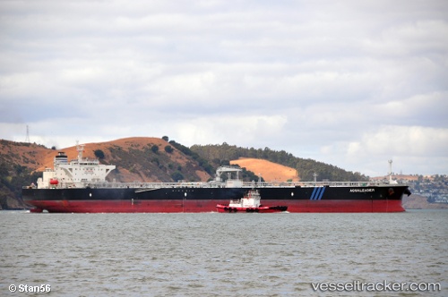
Vessel Aqualeader IMO: 9592238, MMSI: 636015175 Crude Oil Tanker
UTC, 43.44651, -163.50082, course: 71, speed: 10.5
UTC, 43.55687, -163.10429, course: 71, speed: 10.9
2026-03-25 02:22:27 UTC, 43.71606, -162.52373, course: 71, speed: 11.2
Live Vessel Aqualeader Analytics (details, animations, etc.)
Live AIS position: UTC. 297 nm S of Achau), updated 2026-03-25 02:22:27 UTC.Find the position of the vessel Aqualeader on the map. The latter are known coordinates and path.
marine traffic ship tracker show on live map
The current position of vessel Aqualeader is 43.71606 lat / -162.52373 lng. Updated: 2026-03-25 02:22:27 UTCCurrently sailing under the flag of Liberia
Aqualeader built in 2011 year
Deadweight:
115669 tDetails:
Last coordinates of the vessel:
UTC, 43.30302, -164.02335, course: 70, speed: 10.8UTC, 43.44651, -163.50082, course: 71, speed: 10.5
UTC, 43.55687, -163.10429, course: 71, speed: 10.9
2026-03-25 02:22:27 UTC, 43.71606, -162.52373, course: 71, speed: 11.2