 vesseltracker.com
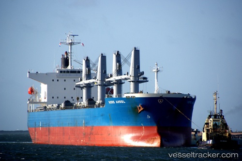
Vessel Mindanao IMO: 9478963, MMSI: 636018354 Bulk Carrier
UTC, 21.94010, 114.91573, course: 262, speed: 11.6
UTC, 21.90560, 114.52157, course: 248, speed: 11.6
2026-03-10 18:14:44 UTC, 21.80712, 114.11772, course: 252, speed: 11.8
Live Vessel Mindanao Analytics (details, animations, etc.)
Live AIS position: UTC. 18 nm S of WAILINGDING ISLAND), updated 2026-03-10 18:14:44 UTC.Find the position of the vessel Mindanao on the map. The latter are known coordinates and path.
marine traffic ship tracker show on live map
The current position of vessel Mindanao is 21.80712 lat / 114.11772 lng. Updated: 2026-03-10 18:14:44 UTCDetails:
Last coordinates of the vessel:
UTC, 22.05574, 115.53875, course: 261, speed: 11.7UTC, 21.94010, 114.91573, course: 262, speed: 11.6
UTC, 21.90560, 114.52157, course: 248, speed: 11.6
2026-03-10 18:14:44 UTC, 21.80712, 114.11772, course: 252, speed: 11.8