 vesseltracker.com
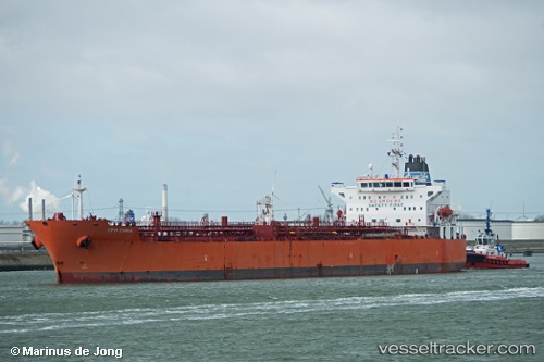
Vessel Olaf IMO: 9434204, MMSI: 636019100 Chemical Oil Products Tanker
UTC, -11.73583, 41.09636, course: 75, speed: 0.8
UTC, -11.73583, 41.09636, course: 75, speed: 0.8
2026-03-24 11:45:56 UTC, -11.73583, 41.09636, course: 75, speed: 0.8
Live Vessel Olaf Analytics (details, animations, etc.)
Live AIS position: UTC. 49 nm SE of MOCIMBOA DA PRAIA), updated 2026-03-24 11:45:56 UTC.Find the position of the vessel Olaf on the map. The latter are known coordinates and path.
marine traffic ship tracker show on live map
The current position of vessel Olaf is -11.73583 lat / 41.09636 lng. Updated: 2026-03-24 11:45:56 UTCCurrently sailing under the flag of Liberia
Olaf built in 2010 year
Deadweight:
51672 tDetails:
Last coordinates of the vessel:
UTC, -11.98977, 40.92257, course: 48, speed: 12.6UTC, -11.73583, 41.09636, course: 75, speed: 0.8
UTC, -11.73583, 41.09636, course: 75, speed: 0.8
2026-03-24 11:45:56 UTC, -11.73583, 41.09636, course: 75, speed: 0.8