 vesseltracker.com
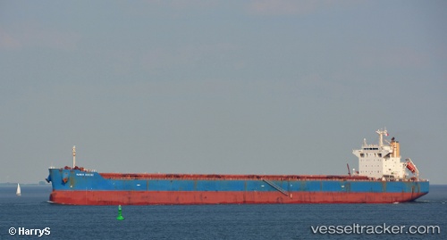
Vessel STAR ELECTRA IMO: 9442536, MMSI: 636019445 Bulk Carrier
UTC, -2.36973, -44.23696, course: 18, speed: 0.2
UTC, -2.36833, -44.23333, course: -1, speed: 0
2026-02-27 09:57:02 UTC, -2.36500, -44.23333, course: -1, speed: 0
Live AIS position:
UTC. Near São Luís),
updated 2026-02-27 09:57:02 UTC.
Find the position of the vessel STAR ELECTRA on the map. The latter are known coordinates and path.
marine traffic ship tracker show on live map
The current position of vessel STAR ELECTRA is -2.36500 lat / -44.23333 lng. Updated: 2026-02-27 09:57:02 UTCCurrently sailing under the flag of Liberia
STAR ELECTRA built in 2011 year
Deadweight:
83494 tDetails:
Last coordinates of the vessel:
UTC, -2.36833, -44.23667, course: -1, speed: 0UTC, -2.36973, -44.23696, course: 18, speed: 0.2
UTC, -2.36833, -44.23333, course: -1, speed: 0
2026-02-27 09:57:02 UTC, -2.36500, -44.23333, course: -1, speed: 0