 vesseltracker.com
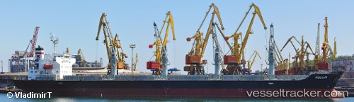
Vessel POLLUX IMO: 9379648, MMSI: 636019890 Bulk Carrier
UTC, 0.85858, -49.82186, course: 270, speed: 10.8
UTC, 0.74631, -50.09061, course: 255, speed: 10.8
2026-02-27 21:53:54 UTC, 0.64775, -50.35916, course: 227, speed: 12.7
Live AIS position:
UTC. 49 nm N of Afuá),
updated 2026-02-27 21:53:54 UTC.
Find the position of the vessel POLLUX on the map. The latter are known coordinates and path.
marine traffic ship tracker show on live map
The current position of vessel POLLUX is 0.64775 lat / -50.35916 lng. Updated: 2026-02-27 21:53:54 UTCCurrently sailing under the flag of Liberia
POLLUX built in 2007 year
Deadweight:
32017 tDetails:
Last coordinates of the vessel:
UTC, 1.14833, -49.55500, course: -1, speed: 10UTC, 0.85858, -49.82186, course: 270, speed: 10.8
UTC, 0.74631, -50.09061, course: 255, speed: 10.8
2026-02-27 21:53:54 UTC, 0.64775, -50.35916, course: 227, speed: 12.7