 vesseltracker.com
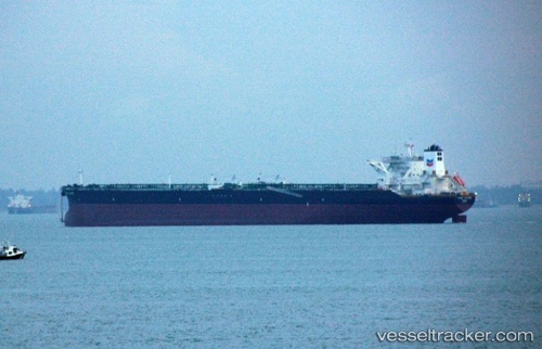
Vessel ALMI HYDRA IMO: 9583720, MMSI: 636019913 Crude Oil Tanker
UTC, 27.13999, 50.25066, course: 103, speed: 0.1
UTC, 27.13845, 50.25102, course: 71, speed: 0
2026-03-20 14:14:31 UTC, 27.14083, 50.25067, course: 120, speed: 0
Live Vessel ALMI HYDRA Analytics (details, animations, etc.)
Live AIS position: UTC. 30 nm N of Ras Tannurah), updated 2026-03-20 14:14:31 UTC.Find the position of the vessel ALMI HYDRA on the map. The latter are known coordinates and path.
marine traffic ship tracker show on live map
The current position of vessel ALMI HYDRA is 27.14083 lat / 50.25067 lng. Updated: 2026-03-20 14:14:31 UTCCurrently sailing under the flag of Liberia
ALMI HYDRA built in 2013 year
Deadweight:
319357 tDetails:
Last coordinates of the vessel:
UTC, 27.14113, 50.25112, course: 123, speed: 0UTC, 27.13999, 50.25066, course: 103, speed: 0.1
UTC, 27.13845, 50.25102, course: 71, speed: 0
2026-03-20 14:14:31 UTC, 27.14083, 50.25067, course: 120, speed: 0