 vesseltracker.com
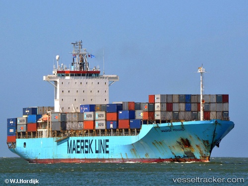
Vessel MAERSK PENANG IMO: 9168192, MMSI: 636020265 Container Ship
UTC, 44.23243, -9.41882, course: -1, speed: 13.6
UTC, 43.75667, -9.79333, course: -1, speed: 14
2026-02-27 19:56:48 UTC, 43.37333, -10.04667, course: -1, speed: 14
Live AIS position:
UTC. 34 nm W of Villanueva de Lorenzana),
updated 2026-02-27 19:56:48 UTC.
Find the position of the vessel MAERSK PENANG on the map. The latter are known coordinates and path.
marine traffic ship tracker show on live map
The current position of vessel MAERSK PENANG is 43.37333 lat / -10.04667 lng. Updated: 2026-02-27 19:56:48 UTCCurrently sailing under the flag of Liberia
MAERSK PENANG built in 1998 year
Deadweight:
38250 tDetails:
Last coordinates of the vessel:
UTC, 44.69833, -9.06833, course: -1, speed: 14UTC, 44.23243, -9.41882, course: -1, speed: 13.6
UTC, 43.75667, -9.79333, course: -1, speed: 14
2026-02-27 19:56:48 UTC, 43.37333, -10.04667, course: -1, speed: 14