 vesseltracker.com
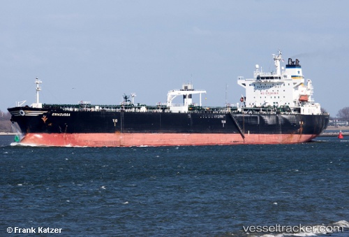
Vessel CAMILLA IMO: 9254850, MMSI: 636020658 Oil Products Tanker
UTC, 29.47735, 48.87138, course: 322, speed: 0.1
UTC, 29.47740, 48.87140, course: -1, speed: 0.1
2026-02-26 00:00:58 UTC, 29.47683, 48.86967, course: -1, speed: 0
Live AIS position:
UTC. 17 nm S of Basrah Oil Terminal),
updated 2026-02-26 00:00:58 UTC.
Find the position of the vessel CAMILLA on the map. The latter are known coordinates and path.
marine traffic ship tracker show on live map
The current position of vessel CAMILLA is 29.47683 lat / 48.86967 lng. Updated: 2026-02-26 00:00:58 UTCCurrently sailing under the flag of Liberia
CAMILLA built in 2003 year
Deadweight:
70142 tDetails:
Last coordinates of the vessel:
UTC, 29.47740, 48.87137, course: 324, speed: 0UTC, 29.47735, 48.87138, course: 322, speed: 0.1
UTC, 29.47740, 48.87140, course: -1, speed: 0.1
2026-02-26 00:00:58 UTC, 29.47683, 48.86967, course: -1, speed: 0