 vesseltracker.com
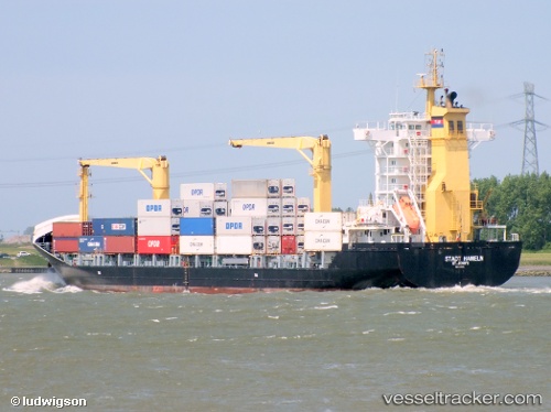
Vessel SC PHILLY IMO: 9330276, MMSI: 636020661 Container Ship
UTC, 10.63833, -71.60167, course: -1, speed: 0
UTC, 10.63833, -71.60167, course: -1, speed: 0
2026-02-27 19:34:21 UTC, 10.74333, -71.57000, course: -1, speed: 10
Live AIS position:
UTC. Near Puerto Miranda),
updated 2026-02-27 19:34:21 UTC.
Find the position of the vessel SC PHILLY on the map. The latter are known coordinates and path.
marine traffic ship tracker show on live map
The current position of vessel SC PHILLY is 10.74333 lat / -71.57000 lng. Updated: 2026-02-27 19:34:21 UTCCurrently sailing under the flag of Liberia
SC PHILLY built in 2007 year
Deadweight:
13749 tDetails:
Last coordinates of the vessel:
UTC, 10.63833, -71.60167, course: -1, speed: 0UTC, 10.63833, -71.60167, course: -1, speed: 0
UTC, 10.63833, -71.60167, course: -1, speed: 0
2026-02-27 19:34:21 UTC, 10.74333, -71.57000, course: -1, speed: 10