 vesseltracker.com
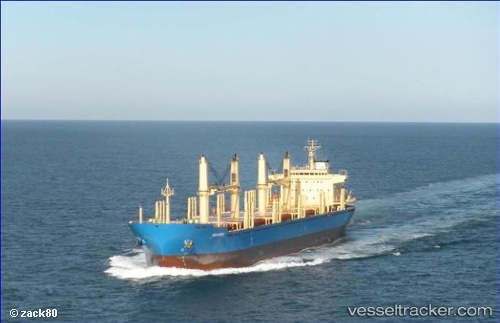
Vessel VISBY IMO: 9563380, MMSI: 636021204 Bulk Carrier
UTC, 28.10506, -15.40718, course: 115, speed: 0.1
UTC, 28.10285, -15.40483, course: 332, speed: 0.1
2026-02-24 22:05:06 UTC, 28.10266, -15.40475, course: 333, speed: 0.1
Live AIS position:
UTC. Near Las Palmas de Gran Canaria),
updated 2026-02-24 22:05:06 UTC.
Find the position of the vessel VISBY on the map. The latter are known coordinates and path.
marine traffic ship tracker show on live map
The current position of vessel VISBY is 28.10266 lat / -15.40475 lng. Updated: 2026-02-24 22:05:06 UTCCurrently sailing under the flag of Liberia
VISBY built in 2010 year
Deadweight:
35052 tDetails:
Last coordinates of the vessel:
UTC, 28.10547, -15.40676, course: 132, speed: 0.1UTC, 28.10506, -15.40718, course: 115, speed: 0.1
UTC, 28.10285, -15.40483, course: 332, speed: 0.1
2026-02-24 22:05:06 UTC, 28.10266, -15.40475, course: 333, speed: 0.1