 vesseltracker.com
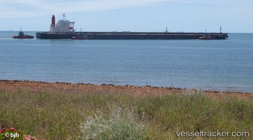
Vessel XIN HAI IMO: 9406477, MMSI: 636021720 Bulk Carrier
UTC, 24.73622, 122.50067, course: 8, speed: 13.4
UTC, 24.73622, 122.50067, course: 8, speed: 13.4
2026-03-24 11:41:19 UTC, 24.73622, 122.50067, course: 8, speed: 13.4
Live Vessel XIN HAI Analytics (details, animations, etc.)
Live AIS position: UTC. 34 nm SE of Nangang), updated 2026-03-24 11:41:19 UTC.Find the position of the vessel XIN HAI on the map. The latter are known coordinates and path.
marine traffic ship tracker show on live map
The current position of vessel XIN HAI is 24.73622 lat / 122.50067 lng. Updated: 2026-03-24 11:41:19 UTCCurrently sailing under the flag of Liberia
XIN HAI built in 2007 year
Deadweight:
206331 tDetails:
Last coordinates of the vessel:
UTC, 24.68463, 122.48377, course: 13, speed: 13.2UTC, 24.73622, 122.50067, course: 8, speed: 13.4
UTC, 24.73622, 122.50067, course: 8, speed: 13.4
2026-03-24 11:41:19 UTC, 24.73622, 122.50067, course: 8, speed: 13.4