 vesseltracker.com
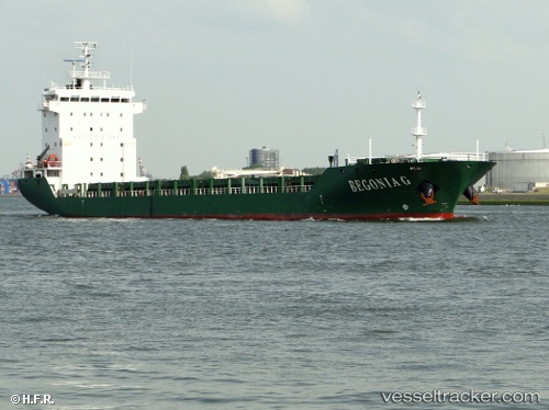
Vessel BEGONIA S IMO: 9445540, MMSI: 636022079 General Cargo Ship
UTC, 40.48169, 26.82397, course: 245, speed: 0.1
UTC, 40.48225, 26.82376, course: 212, speed: 0.1
2026-02-08 10:24:57 UTC, 40.27805, 26.53461, course: 229, speed: 10.8
Live AIS position:
UTC. Near Dardanelles),
updated 2026-02-08 10:24:57 UTC.
Find the position of the vessel BEGONIA S on the map. The latter are known coordinates and path.
marine traffic ship tracker show on live map
The current position of vessel BEGONIA S is 40.27805 lat / 26.53461 lng. Updated: 2026-02-08 10:24:57 UTCCurrently sailing under the flag of Liberia
BEGONIA S built in 2007 year
Deadweight:
12119 tDetails:
Last coordinates of the vessel:
UTC, 40.48204, 26.82322, course: 239, speed: 0.1UTC, 40.48169, 26.82397, course: 245, speed: 0.1
UTC, 40.48225, 26.82376, course: 212, speed: 0.1
2026-02-08 10:24:57 UTC, 40.27805, 26.53461, course: 229, speed: 10.8