 vesseltracker.com
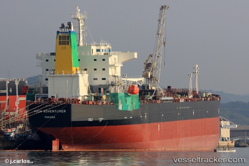
Vessel HIGH ADVENTURER IMO: 9788435, MMSI: 636022286 Tanker
UTC, -16.42375, 64.07599, course: 58, speed: 11.3
UTC, -16.18594, 64.43171, course: 50, speed: 11.6
2026-03-24 19:48:06 UTC, -16.00564, 64.64997, course: 56, speed: 11.5
Live Vessel HIGH ADVENTURER Analytics (details, animations, etc.)
Live AIS position: UTC. 232 nm N of Port Mathurin), updated 2026-03-24 19:48:06 UTC.Find the position of the vessel HIGH ADVENTURER on the map. The latter are known coordinates and path.
marine traffic ship tracker show on live map
The current position of vessel HIGH ADVENTURER is -16.00564 lat / 64.64997 lng. Updated: 2026-03-24 19:48:06 UTCCurrently sailing under the flag of Liberia
Details:
Last coordinates of the vessel:
UTC, -16.68667, 63.71500, course: -1, speed: 11UTC, -16.42375, 64.07599, course: 58, speed: 11.3
UTC, -16.18594, 64.43171, course: 50, speed: 11.6
2026-03-24 19:48:06 UTC, -16.00564, 64.64997, course: 56, speed: 11.5