 vesseltracker.com
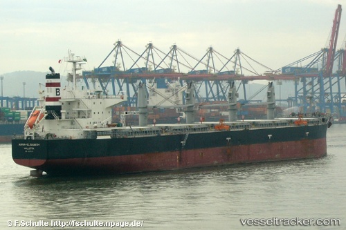
Vessel ANNA ELISABETH IMO: 9407471, MMSI: 636022382 Bulk Carrier
UTC, 18.46552, 64.99398, course: -1, speed: 11.8
UTC, 18.62874, 65.44600, course: -1, speed: 11.8
2026-03-25 03:57:55 UTC, 18.76528, 65.82923, course: 34, speed: 11.8
Live Vessel ANNA ELISABETH Analytics (details, animations, etc.)
Live AIS position: UTC. 286 nm SW of Veraval), updated 2026-03-25 03:57:55 UTC.Find the position of the vessel ANNA ELISABETH on the map. The latter are known coordinates and path.
marine traffic ship tracker show on live map
The current position of vessel ANNA ELISABETH is 18.76528 lat / 65.82923 lng. Updated: 2026-03-25 03:57:55 UTCCurrently sailing under the flag of Liberia
Details:
Last coordinates of the vessel:
UTC, 18.31333, 64.55167, course: -1, speed: 11UTC, 18.46552, 64.99398, course: -1, speed: 11.8
UTC, 18.62874, 65.44600, course: -1, speed: 11.8
2026-03-25 03:57:55 UTC, 18.76528, 65.82923, course: 34, speed: 11.8