 vesseltracker.com
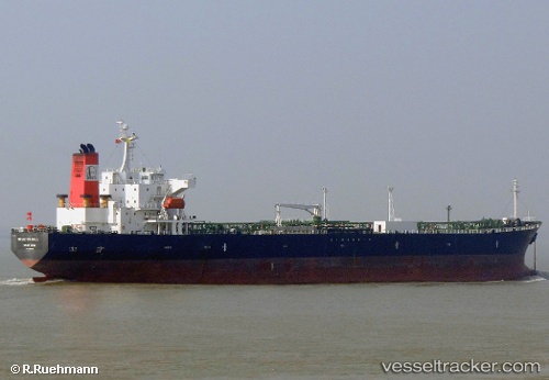
Vessel ANNA MARIA P IMO: 9288368, MMSI: 636023192 Oil Products Tanker
UTC, 13.51236, -17.18135, course: 12, speed: 9.3
UTC, 13.53835, -17.16692, course: 48, speed: 0.8
2026-01-17 23:34:12 UTC, 13.53646, -17.16500, course: 46, speed: 1.7
Live AIS position:
UTC. 28 nm W of Sukuta),
updated 2026-01-17 23:34:12 UTC.
Find the position of the vessel ANNA MARIA P on the map. The latter are known coordinates and path.
marine traffic ship tracker show on live map
The current position of vessel ANNA MARIA P is 13.53646 lat / -17.16500 lng. Updated: 2026-01-17 23:34:12 UTCCurrently sailing under the flag of Liberia
ANNA MARIA P built in 2005 year
Deadweight:
47278 tDetails:
Last coordinates of the vessel:
UTC, 13.37165, -17.26058, course: 22, speed: 11.1UTC, 13.51236, -17.18135, course: 12, speed: 9.3
UTC, 13.53835, -17.16692, course: 48, speed: 0.8
2026-01-17 23:34:12 UTC, 13.53646, -17.16500, course: 46, speed: 1.7