 vesseltracker.com
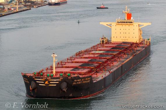
Vessel HL PORT HEDLAND IMO: 9454527, MMSI: 636025664 Cargo
UTC, 24.84338, 132.78415, course: 339, speed: 9.5
UTC, 25.11078, 132.61411, course: 335, speed: 9.9
2026-02-28 09:06:23 UTC, 25.11078, 132.61411, course: 335, speed: 9.9
Live AIS position:
UTC. 87 nm SE of Minamidaito),
updated 2026-02-28 09:06:23 UTC.
Find the position of the vessel HL PORT HEDLAND on the map. The latter are known coordinates and path.
marine traffic ship tracker show on live map
The current position of vessel HL PORT HEDLAND is 25.11078 lat / 132.61411 lng. Updated: 2026-02-28 09:06:23 UTCCurrently sailing under the flag of Liberia
Details:
Last coordinates of the vessel:
UTC, 24.49917, 132.97272, course: 339, speed: 9.2UTC, 24.84338, 132.78415, course: 339, speed: 9.5
UTC, 25.11078, 132.61411, course: 335, speed: 9.9
2026-02-28 09:06:23 UTC, 25.11078, 132.61411, course: 335, speed: 9.9