 vesseltracker.com
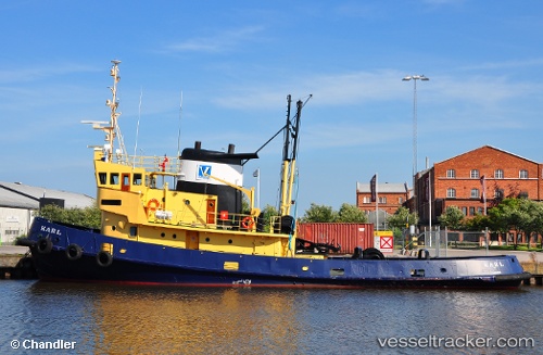
Vessel Karl Af Karlstad IMO: 6420642, MMSI: 265510870 Tug
UTC, 59.36576, 13.52828, course: 343, speed: 0
UTC, 59.36576, 13.52828, course: 343, speed: 0
2026-02-25 23:01:42 UTC, 59.36576, 13.52828, course: 343, speed: 0
Live AIS position:
UTC. Near KARLSTAD),
updated 2026-02-25 23:01:42 UTC.
Find the position of the vessel Karl Af Karlstad on the map. The latter are known coordinates and path.
marine traffic ship tracker show on live map
The current position of vessel Karl Af Karlstad is 59.36576 lat / 13.52828 lng. Updated: 2026-02-25 23:01:42 UTCDetails:
Last coordinates of the vessel:
UTC, 59.36577, 13.52824, course: 343, speed: 0UTC, 59.36576, 13.52828, course: 343, speed: 0
UTC, 59.36576, 13.52828, course: 343, speed: 0
2026-02-25 23:01:42 UTC, 59.36576, 13.52828, course: 343, speed: 0