 vesseltracker.com
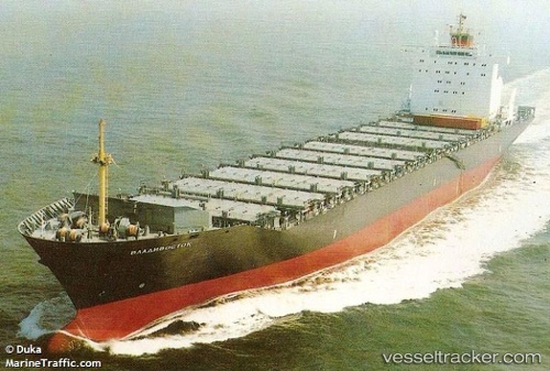
Vessel VLADIVOSTOK IMO: 9130145, MMSI: 667001869 Container Ship
UTC, 35.04820, 129.61931, course: 37, speed: 15.4
UTC, 35.58335, 129.89087, course: 10, speed: 15.5
2026-03-20 15:17:04 UTC, 35.91340, 129.96230, course: -1, speed: 15.1
Live Vessel VLADIVOSTOK Analytics (details, animations, etc.)
Live AIS position: UTC. 20 nm E of Guryongpo), updated 2026-03-20 15:17:04 UTC.Find the position of the vessel VLADIVOSTOK on the map. The latter are known coordinates and path.
marine traffic ship tracker show on live map
The current position of vessel VLADIVOSTOK is 35.91340 lat / 129.96230 lng. Updated: 2026-03-20 15:17:04 UTCCurrently sailing under the flag of Sierra Leone
Details:
Last coordinates of the vessel:
UTC, 34.64626, 129.17851, course: 43, speed: 15.1UTC, 35.04820, 129.61931, course: 37, speed: 15.4
UTC, 35.58335, 129.89087, course: 10, speed: 15.5
2026-03-20 15:17:04 UTC, 35.91340, 129.96230, course: -1, speed: 15.1