 vesseltracker.com
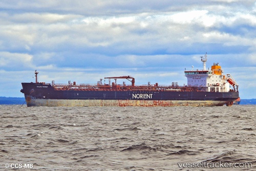
Vessel OCEAN EMBRACE IMO: 9327372, MMSI: 667002210 Oil/Chemical Tanker
UTC, 68.99873, 33.03287, course: 149, speed: 0
UTC, 68.99873, 33.03287, course: 149, speed: 0
2026-03-20 12:30:45 UTC, 68.99873, 33.03287, course: 149, speed: 0
Live Vessel OCEAN EMBRACE Analytics (details, animations, etc.)
Live AIS position: UTC. Near Murmansk), updated 2026-03-20 12:30:45 UTC.Find the position of the vessel OCEAN EMBRACE on the map. The latter are known coordinates and path.
marine traffic ship tracker show on live map
The current position of vessel OCEAN EMBRACE is 68.99873 lat / 33.03287 lng. Updated: 2026-03-20 12:30:45 UTCCurrently sailing under the flag of Sierra Leone
Details:
Last coordinates of the vessel:
UTC, 68.99883, 33.03340, course: 169, speed: 0.1UTC, 68.99873, 33.03287, course: 149, speed: 0
UTC, 68.99873, 33.03287, course: 149, speed: 0
2026-03-20 12:30:45 UTC, 68.99873, 33.03287, course: 149, speed: 0